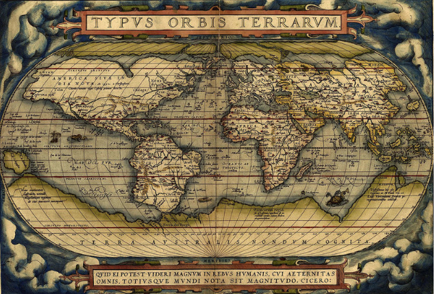
How Mapmakers Dealt With The Discovery Of Vast Oceans
November 15, 2017 in Daily Bulletin

Genevieve Carlton wrote about maps:
- Voyagers like Christopher Columbus and Amerigo Vespucci found distant continents – and in the process forced European mapmakers to deal with the vastness of the oceans.
- Often they would shrink the size of the Atlantic ocean – making the new world seem much closer than it really was.
- Some were outraged by the scarcity of land in the southern hemisphere – and reasoned that there must be an undiscovered continent in the south, which they called “Terra Australis Nondum Cognita” – southern land not yet known (see image above)
- When Europeans ran into Australia they assumed that this was the fabled southern mega-continent, thus explaining how Australia got its name.
- The oceans could be used for branding purposes. Mapmaker André Thévet, for example, names a series of non-existent islands after himself in the ocean.
- One Venetian nationalist littered the vast oceans with Venetian galleys – entirely unsuited for trans-oceanic travel, but propagating what was, by that point, the myth of Venice’s pre-eminence.
Read more and see the visual evolution of maps on Atlas Obscura here.
Join the Discussion! (No Signup Required)