Spotting Overfishing With Google Maps
November 27, 2013 in Daily Bulletin

There are sometimes stories of the Google cars catching criminals in the act or even knocking over donkeys. But what about catching industrial scale overfishing?
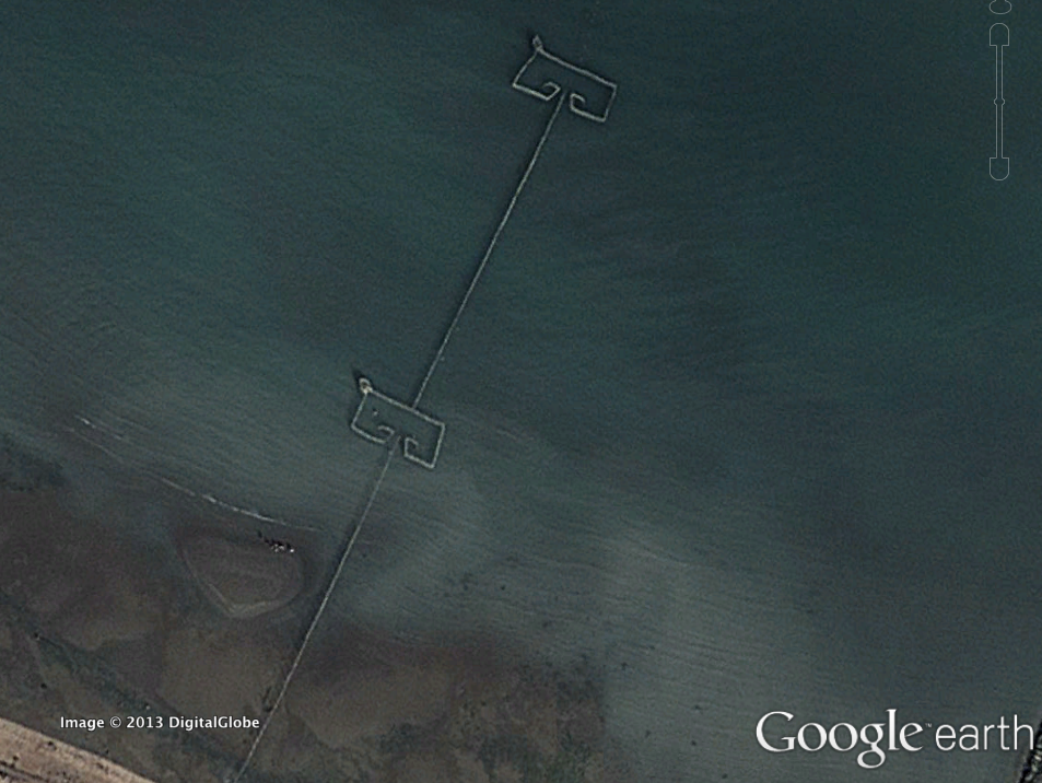
- One way of catching fish on a large scale is by weir; a large, non-moving construct to catch fish (see picture above)
- Researchers contacted local, Persian-gulf academics to find out how many fish were caught per wier.
- Using Google images, the academics counted up the number of weirs, multiplied by average yields and estimated under-reporting of fishing catches.
- The worst offenders are estimated to be Bahrain, reporting around a tenth of catches, and Iran. Though, Iran doesn’t actually bother reporting any of it’s fishing to the Food and Agriculture Organisation.
- Inaccuracies in reported fishing can lead to depletion of fish stocks, and bad policy decisions.
For an overview head over to Quartz, which has a link to the very short and readable journal article.
Source: Quartz
Join the Discussion! (No Signup Required)